Violent Gentrification: Conflict & Redevelopment
We are building an interactive web platform that visualizes the urban transformation of Sur, a historic district of the Kurdish city of Diyarbakir in Turkey and a UNESCO World Heritage Site. Our aim is to show how the spatial practices of urban warfare - tactical incursions, mandatory curfews and evacuation routes - functioned as instruments of real estate development during and after the 2015 military operation that took place across the predominantly Kurdish cities in Turkey's southeast.
With a digital platform that will display detailed timelines of the conflict, widespread destruction, legal cases, development plans, and post-conflict reconstruction, we aim to show that the spatial features of the 2015 conflict between the Turkish military and the PKK in Diyarbakir enabled the subsequent real estate marketization at a massive and otherwise impossible scale in the historic city center Sur.
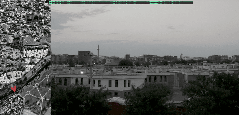
Satellite view of Sur from before till after the 2015-2016 military operation.
The platform visually documents the urban development plans the Turkish state had failed to realize years before the conflict. It then illustrates how the conflict and various risk assessments were used as a pretense for wide scale displacement of citizens, demolition of the built environment, and finally the realization of the long planned urban redevelopment plan.

General site map geolocating some of the key events and visual media before, during, and after the military operation
and showing the spatial operations of armed conflict as engine of development.

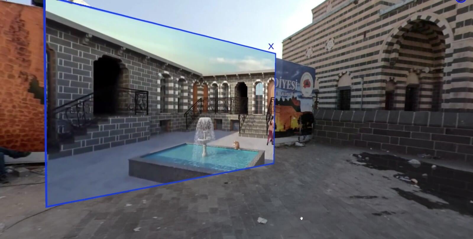
Image of a feature shown on the map: new buildings in an inaccessible neighborhood,
built after the military operation.

Hand-drawn map by a displaced resident, combined with a satellite image showing the area depicted in the map. a photo of the new buildings in that area, and an audio of the testimony, with English translation. Coupling visual documentation with testimonies of the displaced and juxtaposing the pre- and post-operation cityscape, the platform will reveal the dramatic loss of Sur's social, cultural and built environment.
Countersurvey
The “countersurvey” project is a set of methods developed specifically to witness the landscape of civic warfare by adopting and retooling the protocols of the survey form. The process of surveying-- as a preparation for cartography-- conventionally advances such aims as extraction, non-consensual development, and even military operations. In Sur, surveying served precisely these goals. Below you see geolocated images from the 2013 photographic survey of Sur, documenting the urban fabric as part of the Risk Area designation. The photos from the survey are generally of structures that no longer exist. This is precisely because the survey was instrumentalized as evidence in the expropriation of Sur, which legalized its demolition. These are destructive images, then, sweeping the streets and bringing down buildings one by one, even as they comprehensively archive the urban fabric.
The countersurvey approach seeks to actively undo the ties between the survey-image and colonial objectives in order to produce new ways of seeing and understanding such situations. This has taken on two forms. In the first instance, we are working to produce a scaled, navigable 3D model of threatened neighborhoods in Sur using photogrammetry. We hope that this will become a platform for the cultivation and preservation of a virtual form of urban memory against ongoing State-led destruction.
In the second, we have pieced together what we call the landscape-testimony: a unique kind of image that combines testimony from displaced residents with current footage of the sites that they describe and satellite images indicating the contextual situation at present as well as the vantage of the image’s production itself. This last feature is critical, as the sites in question are all behind the State’s barricades, in a zone of enforced opacity where warfare bleeds into development. In order to get footage of this zone, we needed to climb up onto the city’s ancient ramparts. Once elevated, we had to coordinate our vision and that of our camera with GPS information in order to find the testimonial site in what has become an unrecognizable landscape: both razed to the ground and rebuilt with what appears to be an alien simulation. These techniques of countersurvey are meant to fortify what remains of Sur’s unique urban life, and to produce new ways of visualizing its strange and imperilled situation.
Toledo, Turkey
During two month of research in Diyarbakır, Turkey in the context of an independent election observation in 2018, several interviews with local organizations and community members were conducted. These testimonies were used in combination with 360° videos of the city to create an interactive documentation. The application offers the possibility to »visit« different places within the historic city center of Diyarbakır and provides various information about the situation on site.
The project consolidates the testimonies of the community members in a three dimensional visualization of the place of events. This allows the observer a heightened immersion with the local situation and consequently aims to increase understanding of the conflict and its consequences.
Surun Avlu ve Sokakları (Sur's Courtyards and Streets)
A website project, Sur's Courtyards and Streets aims to archive the unique urban fabric of Diyarbakir's ancient city center. It documents the destruction and transformation of Sur from the process of urban renovation, which began in 2009, to the demolitions following the 2015-2016 military operations across the cities of Turkey's predominantly Kurdish southeast.